
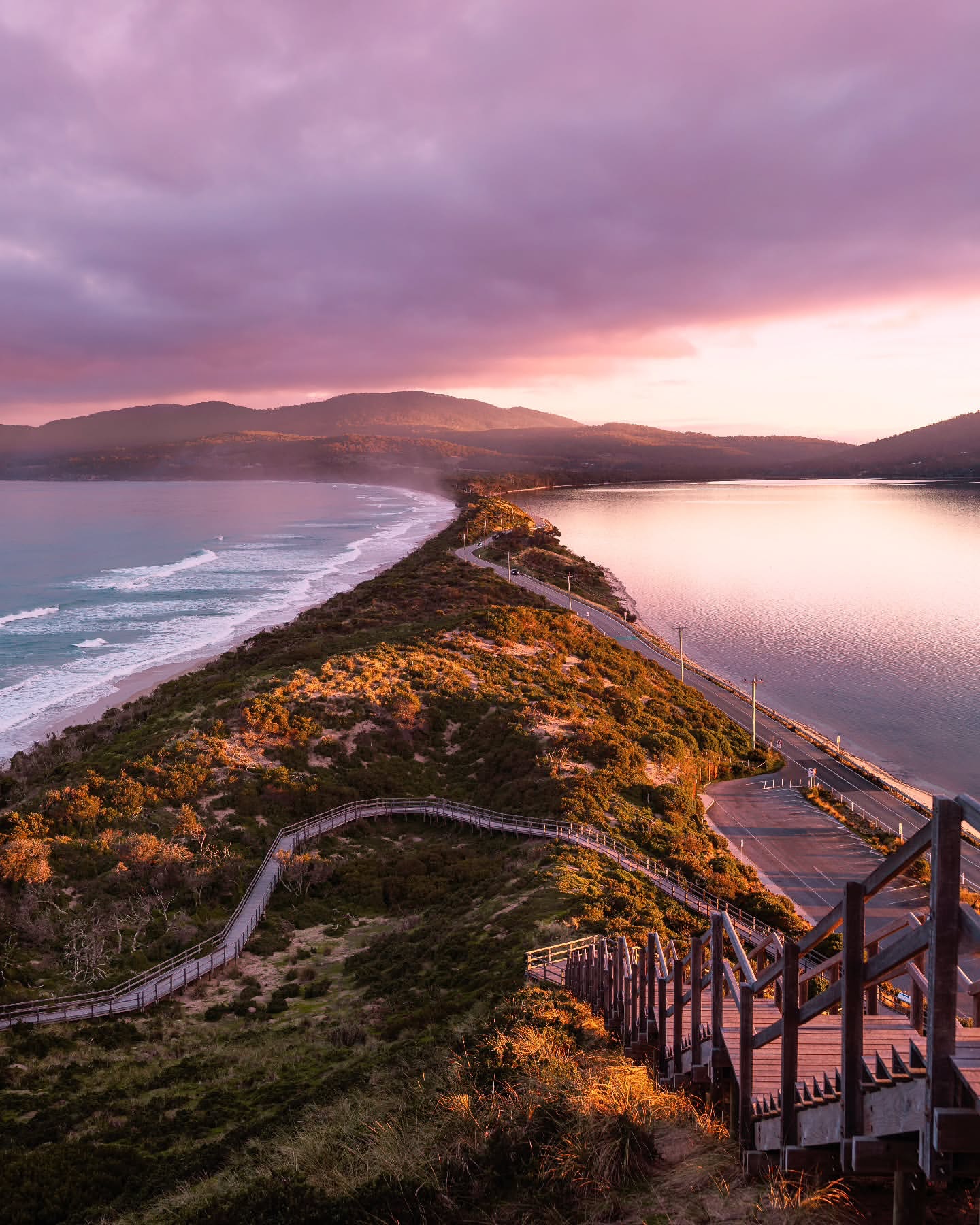
The Neck is Bruny Island's defining view, but it is not the island. Bruny stretches for more than 50 km from the ferry terminal to the southern end, with long drives, coastal walks and enough detours that a day can disappear quickly.
The best first visit is selective. Stop at The Neck, then choose one substantial walk or continue south towards Adventure Bay and Cape Bruny rather than trying to fit every headline stop between two ferry queues.
How to get there
Bruny Island is reached by vehicle ferry from Kettering, around 35 to 40 minutes south of Hobart. The crossing to Roberts Point takes about 20 minutes.
SeaLink operates the ferry on a queueing system. Tickets can be bought in advance, but they do not reserve a particular departure, so allow extra time during busy periods.
Once on Bruny, distances are larger than they look on a map. It takes more than an hour to drive from the ferry to Cape Bruny, and some roads are unsealed. Standard two-wheel-drive vehicles can reach the main visitor areas in normal conditions.
SeaLink tickets are return fares and pre-purchasing does not reserve a departure. The service runs on a queueing system, so an online ticket removes the payment step but not the need to wait for the next available ferry. In peak periods, build a meaningful buffer into both crossings.
What to see and do
The Neck
The boardwalk and steps to Truganini Lookout give the classic view along the narrow isthmus joining North and South Bruny. Stop here early enough to enjoy it without turning the rest of the island into a race.
Little penguins use the surrounding coastline, particularly around dusk. If you are there later in the day, follow the viewing guidance and keep disturbance to a minimum.
Cape Queen Elizabeth and Mars Bluff
The Cape Queen Elizabeth walk is one of the best reasons to spend more than a few roadside stops on Bruny. The full outing is roughly 13 km and around four hours, crossing heathland and beach country towards Mars Bluff and the coast beyond.
Tide conditions affect beach access around Mars Bluff, so check before setting out. When the beach route is not appropriate, use the inland track rather than forcing a coastal shortcut.
Adventure Bay and Fluted Cape
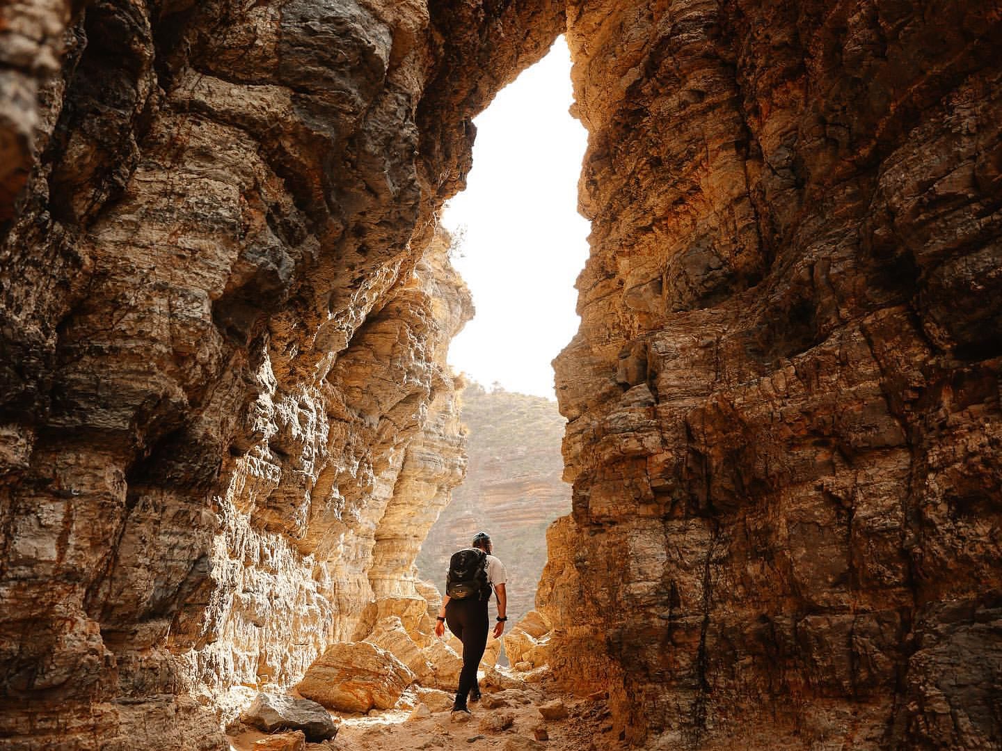
Adventure Bay is the useful base for two very different walks. Grass Point is a 4 km Grade 2 return walk taking about 1.5 hours. Fluted Cape is also about 4 km, but the Grade 4 circuit takes around 2.5 hours and climbs steeply beside exposed sea cliffs.
The Fluted Cape circuit should be walked clockwise as advised by Parks and Wildlife. If you have already completed Cape Queen Elizabeth, adding another major walk on the same day is usually unnecessary.
The easier Grass Point option is 4 km return, Grade 2 and takes about 1.5 hours. It follows the coast from Adventure Bay to the remains of a nineteenth-century whaling station, with only occasional boulder-strewn sections near the point.
Continuing onto Fluted Cape turns the outing into a Grade 4 circuit. Walk it clockwise as directed by Parks and Wildlife: the track climbs to exposed cliff-top views, then descends steeply back towards Adventure Bay. There are no facilities on the track; public toilets are near Adventure Bay Hall.
Cape Bruny Lighthouse
The southern drive finishes at Cape Bruny, around 1 hour 15 minutes from the ferry terminal. The lighthouse grounds are open to visitors, while access inside the tower is by guided tour.
The final section of road and the open headland make Cape Bruny feel properly removed from the busier northern island. If you drive this far, leave enough time to enjoy the headland before starting the long return to the ferry.

Vehicle access to the lighthouse grounds is normally 9.30am to 4.30pm, with pedestrian access outside those hours. The grounds can be explored independently, but climbing the lighthouse tower itself requires a guided tour.
The small Cape Bruny Lightstation Museum beside the car park is worth adding if you have driven this far, particularly because the lighthouse was first lit in 1838 and remained an active light until 1996.
Wildlife along the way
Wallabies, echidnas and birdlife are regularly encountered around Bruny's quieter roads and walking tracks. Slow down around dawn and dusk, when wildlife is more likely to be on or beside the road.
Around the Fluted Cape entrance, white Bennett's wallabies are sometimes seen feeding around dusk. Slow road speeds matter as much as deliberate wildlife stops: pademelons, echidnas, wombats and possums can all appear on or beside the island's roads.
Cloudy Bay and East Cloudy Head
Cloudy Bay gives South Bruny a more exposed coastal character than the sheltered stretches around Adventure Bay. The East Cloudy Head walk starts at the end of Cloudy Bay Road, follows about 3 km of beach and then an old vehicle track towards an open headland. Parks Tasmania grades the full 12 km return walk 4 and allows four hours. This is a substantial alternative to Fluted Cape, not an additional short stop.
During spring and summer, shorebirds nest on the upper beach. Keep to the wet sand and follow the current walking and wildlife advice.
How much time to allow
A full day is the minimum for a useful first visit. An overnight stay is better if you want a major walk as well as the southern end of the island.
Ferry queues and driving distances matter. A day trip works well when you choose between Cape Queen Elizabeth and the longer South Bruny loop rather than trying to complete both.
Practical notes
- The Kettering to Roberts Point ferry crossing takes about 20 minutes.
- Pre-purchased ferry tickets do not reserve a specific sailing. Allow time to queue.
- A Tasmania parks pass is required for South Bruny National Park.
- Seasonal campfire bans have applied to reserved land on Bruny Island since 26 October 2026. Campfires, pot fires and other solid-fuel stoves are prohibited; gas stoves and gas barbecues are permitted. Check the current Parks Tasmania campfire rules before camping.
- Some island roads are unsealed, though the main visitor routes are normally suitable for two-wheel-drive vehicles.
- Check tides before using the beach route around Mars Bluff.
- Keep a generous buffer for the return ferry, especially after a long walk or a drive to Cape Bruny.
- Drive cautiously around dawn and dusk because wildlife is frequently near the road.
- A pre-purchased ferry ticket does not book a time slot. Join the vehicle queue and take the next available sailing.
- Public facilities are concentrated around settlements and major stops. Longer walks such as Fluted Cape should be started with your own water and food.
A suggested plan
Take an early ferry and stop at The Neck on the way south. From there, choose your day: walk Cape Queen Elizabeth and Mars Bluff, or continue to Adventure Bay and Cape Bruny with a shorter walk such as Grass Point.
If you stay overnight, the pressure comes off immediately. Use one day for a longer walk and the other for the southern road, lighthouse and wildlife stops.