
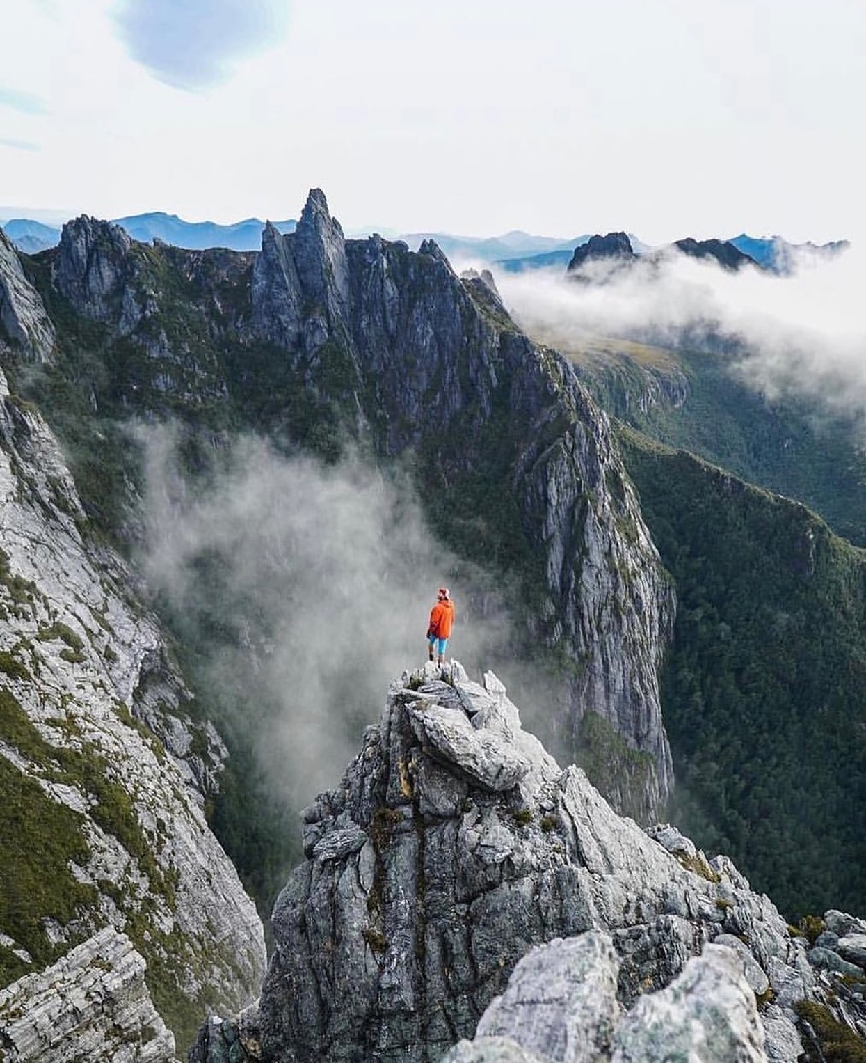
Federation Peak gives the Eastern Arthurs their silhouette, but it should not distort what the trip is. The 72 km traverse is already one of Tasmania's most serious walking routes without stepping onto the summit. Cliffs, scrub, exposed scrambling, slow ridges and creek crossings make the range an expedition rather than a long trail.
Parks Tasmania is unusually direct about the risk: this route is not suitable for beginners or lightly experienced walkers, and people have died here.
How to get there
The Eastern Arthur Range can be approached from Scotts Peak Dam, the Huon Track or Farmhouse Creek, and the traverse can be walked in either direction. The official walk notes describe a route from Scotts Peak through to Farmhouse Creek.
As of October 2026, West Picton Road is closed at Cook Creek. Walkers using the Farmhouse Creek end must add an extra 6.1 km one way along the road between the closure and the former trailhead.
What to see and do
The traverse, not just the peak
The official traverse runs through Arthur and Cracroft Plains before climbing onto the range via Luckmans Lead. Once high, the route alternates between exposed rock, scrub, gullies and narrow ridges where progress is measured in terrain rather than kilometres.
Hanging Lake and Bechervaise Plateau
Hanging Lake and Bechervaise Plateau are key camps near Federation Peak. Reaching them involves steep descents and exposed scrambling, and the descent towards Bechervaise should only be attempted with good visibility if you are unfamiliar with the route.
Federation Peak
The summit is optional and is not included in the standard traverse walk notes. The final route involves significant exposure and technical climbing skills; a fall can be fatal. For many experienced walkers, the correct Eastern Arthurs trip is the traverse without a Federation Peak ascent.
Moss Ridge and the Farmhouse Creek side
Moss Ridge has a reputation for good reason. It is steep, slippery and slow, with sections where pack hauling can be necessary. Beyond it, river and creek crossings can become dangerous after rain.
How much time to allow
Parks Tasmania lists six to nine days for the 72 km Grade 5 traverse. Current Farmhouse Creek access adds another 6.1 km one way if that end of the route is used, so logistics and daylight margins need to reflect the closure.
A spare weather day is not indulgent here. It is part of sensible planning for a range where cloud, wind and wet quartzite can remove safe options quickly.
Practical notes
- Registration is required for the Eastern Arthur Range Traverse.
- There are no huts and only limited campsite infrastructure. Carry a full shelter and be self-sufficient.
- Do not rely on phone-based navigation. Carry a paper map and compass and know how to use them.
- Federation Peak is an optional technical objective, not a required part of the traverse.
- West Picton Road is currently closed at Cook Creek, adding 6.1 km one way to the Farmhouse Creek approach.
- Check all current Southwest National Park alerts immediately before departure.
A suggested plan
Choose the start and transport arrangement first, register the walk, then build a six-to-nine-day route around the official camp sequence with at least one weather margin. Treat Federation Peak as a separate decision to be made only on the range, in suitable conditions, by people with the required technical experience.