Flinders Island rewards people who stop trying to cover ground quickly. It is the largest island in the Furneaux Group, with more than 150 beaches, granite mountains, wetlands and a small population spread between Whitemark, Lady Barron and a handful of smaller settlements.
The distances are manageable, but the island works best over several days. Castle Rock gives you the classic granite coastline; Strzelecki National Park provides the strongest walking; Killiecrankie takes you north into a very different landscape; and places such as Wybalenna and Furneaux Museum give the island historical depth that the beaches alone cannot.
How to get there
Flying is the usual way to reach Flinders Island. Sharp Airlines operates the regular public transport service from Launceston and Essendon, with the flight from Launceston taking about 35 minutes and the Melbourne service roughly an hour. Schedules vary seasonally, so book the actual flight before arranging the rest of the trip.
If you want to bring your own vehicle, a freight service operates between Bridport and Lady Barron at least weekly. The sea crossing is much slower and sailings are limited, so it suits travellers who specifically want their own car or are staying longer.
Once on the island, a vehicle changes the trip completely. There is no public transport, and local visitor information strongly recommends arranging a hire car before arrival. The island has around 450 km of sealed and unsealed roads, with the normal road network suitable for standard 2WD vehicles.
Whitemark is the main service centre. Stock up before heading north: Flinders Council advises that north of Whitemark there are no places to buy fuel, food or drinks. Mobile coverage is Telstra only and remains patchy in parts of the island.
What to see and do
Castle Rock and Marshall Bay
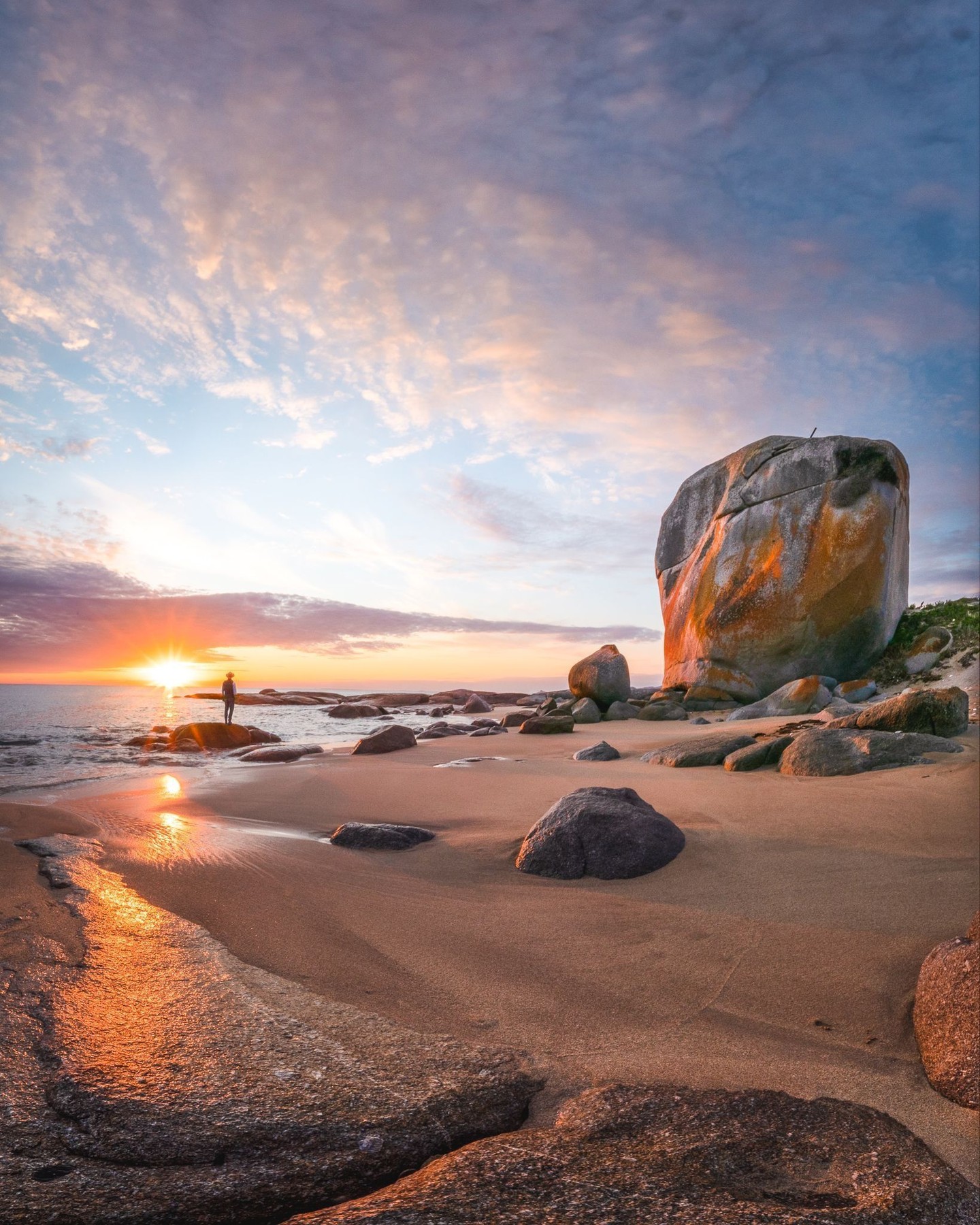
Castle Rock is the clearest introduction to Flinders Island's west coast. The enormous granite boulder sits on Marshall Beach among smaller orange-lichened rocks, reached on a coastal walk from the Allports Beach area.
Tasmania Parks and Wildlife Service lists the walk as 6.6 km return, about 1.5 hours and Grade 3. In practice, allow closer to two or three hours if you want to stop along the beaches, photograph the coastline and avoid treating the return as a timed walk.
Low tide is the better choice because more of the rocky shoreline is exposed and the route is easier to read. In large seas, stay back from the water and watch for waves reaching further onto the rocks than expected.
Nearby Allports Beach has toilets, picnic tables, wood barbecues and tank water, making it the sensible place to stop before or after the walk.
Strzelecki National Park
The south-west corner of the island is dominated by the Strzelecki Peaks, with the mountains rising directly behind white beaches and clear water. A valid national parks pass is required within Strzelecki National Park.
For a shorter walk, Trousers Point is the easy choice: a 2 km Grade 2 circuit taking about 1.5 hours, linking Trousers Point Beach with Fotheringate Beach through granite headlands and coastal vegetation. The area also has toilets, picnic facilities, barbecues and a basic campground.
If you want the major island hike, Strzelecki Peaks is 5.6 km return, Grade 4 and around four to five hours. The track climbs from near sea level to 756 m Mount Strzelecki through forest, heath and exposed granite before opening into views across the Furneaux islands and, in very clear conditions, towards mainland Tasmania.
Do not treat the summit as guaranteed. Strong westerly winds and fast weather changes are normal here, and Parks and Wildlife advises against the walk during high fire danger.
The beaches
Flinders Island has enough coastline that a beach does not need to be a formal attraction to be worth stopping for. The west is shaped by granite headlands and white sand, while the east opens into quieter lagoons, wetlands and long stretches of coast.
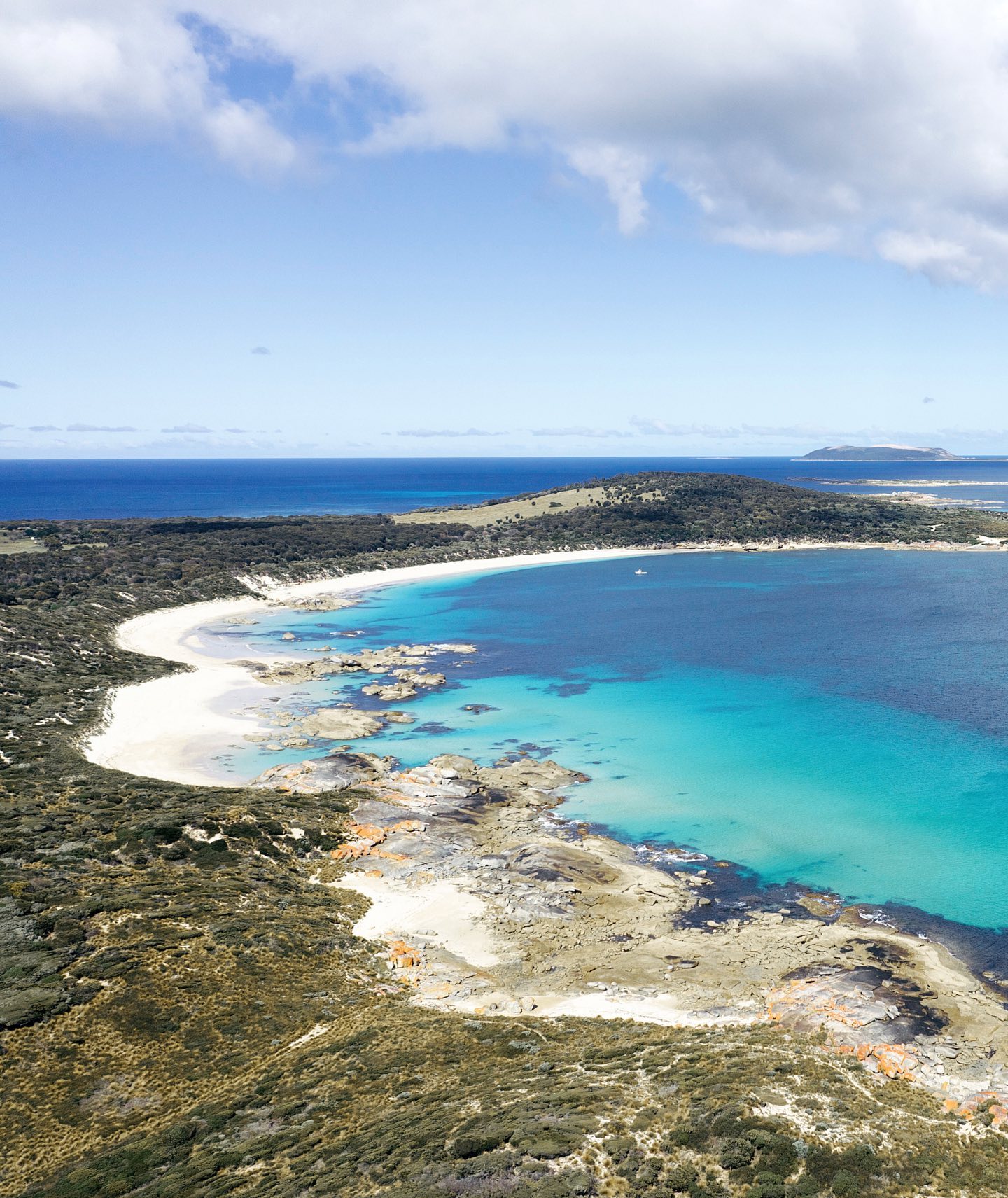
Trousers Point is the most obvious swimming stop within the national park, but Allports, Emita, Palana and Yellow Beach all give different reasons to leave the car. Beaches are unpatrolled, so clear water should not be mistaken for controlled conditions.
Killiecrankie and the north
Drive north from Whitemark towards Killiecrankie for another version of the island. Killiecrankie Bay sits beneath granite mountains and is famous for the semi-precious topaz known locally as Killiecrankie diamonds.
The stones are topaz crystals associated with the island's granite geology. Low tide is the useful time to look, and local operators can advise on current fossicking areas and equipment hire. Treat the activity as a geological curiosity rather than assuming every handful of sand contains a gemstone.
Continue to Palana if you have the day. The road reaches wide northern beaches and the remains of a small Second World War radar settlement before the island narrows towards North East River.
Wybalenna and Furneaux Museum
Flinders Island also carries one of Tasmania's most difficult colonial histories. At Wybalenna, Aboriginal people from mainland Tasmania were forcibly exiled during the 1830s and 1840s. Flinders Council records that more than 150 of roughly 200 people sent there died before the settlement was closed in 1847.
The chapel and cemetery remain. This is a place to approach quietly and read carefully, not another scenic stop on a road-trip checklist.
Nearby in Emita, Furneaux Museum gives much broader context to the islands, with material on Wybalenna, shipwrecks, muttonbirding, farming, geology, local families and the Furneaux Group's natural history. The museum is volunteer-run and opening days change seasonally, so check before planning the day around it.
Lady Barron and the southern coast
Lady Barron is the island's working port and the arrival point for the vehicle freight service. The foreshore track to Yellow Beach is 1.75 km one way and takes about 25 minutes, passing coastal vegetation, granite and views across Franklin Sound towards Cape Barren Island.
Between November and May, short-tailed shearwaters return to rookeries around the Furneaux Group in enormous numbers. Dusk around the southern and central coast can be particularly good for birdlife, but avoid driving quickly after dark when wildlife is most active on the roads.
How much time to allow
Three days is the practical minimum for a first visit. That gives enough time for one substantial south-island day around Strzelecki National Park, one central-west day around Castle Rock, Emita and Wybalenna, and one northern day towards Killiecrankie and Palana.
Four or five days is better if you want to climb Strzelecki Peaks, spend time at beaches rather than simply photograph them, or build the trip around wildlife, fishing or slower northern drives. Weather can also change the order of your plans, so avoid booking every day around a fixed outdoor activity.
Island logistics reward a little preparation. Sunday trading is limited, restaurant kitchens can close earlier than visitors expect, and businesses do not necessarily open every day. Book accommodation, car hire and important meals before arrival, then leave enough space in the itinerary to follow the weather and tides.
Practical notes
- Book a hire vehicle before arrival. There is no public transport network for exploring the island.
- Telstra is the only mobile network with island coverage and reception remains patchy in places.
- North of Whitemark there are no places to buy fuel, food or drinks, so stock up before heading north.
- A valid national parks pass is required for Strzelecki National Park.
- Flinders Island beaches are unpatrolled. Assess swimming and swell conditions conservatively.
- Low tide is useful for Castle Rock and Killiecrankie, while exposed mountain walks should be planned around the weather rather than a fixed itinerary.
A suggested plan
Use one day for Strzelecki National Park and Trousers Point, one for Castle Rock, Emita, Wybalenna and Furneaux Museum, and one for the northern drive through Killiecrankie towards Palana. With four or five days, add Strzelecki Peaks, slower beach time and more flexibility for wind and weather.