

kunanyi / Mount Wellington rises directly behind Hobart, which makes the summit unusually easy to reach for a mountain of this scale. That accessibility can disguise how quickly the environment changes: rainforest and tall forest lower down give way to snow gums, boulder fields and exposed alpine weather at 1,271 m.
A useful first visit has two layers. The Pinnacle gives the broad view over Hobart and southern Tasmania; The Springs, 550 m lower, is where the mountain starts to make more sense on foot.
How to get there
Pinnacle Road is the only public road into Wellington Park. It begins at Fern Tree and climbs through The Springs to the summit. The road is sealed and suitable for conventional vehicles, but it is narrow, winding and shared with buses, cyclists and walkers at several points.
From central Hobart, allow about 30 minutes to reach the summit in normal conditions. Snow and ice can close Pinnacle Road at any time of year, particularly from April to September. Check the live road status before leaving the city rather than assuming a clear Hobart morning means the summit road is open.
If you do not want to drive, the kunanyi / Mount Wellington Explorer Bus runs from Hobart to Fern Tree, The Springs, The Chalet, Big Bend and The Pinnacle. It can also be used one-way, which is particularly useful if you plan to walk down from the summit.
What to see and do
The Pinnacle
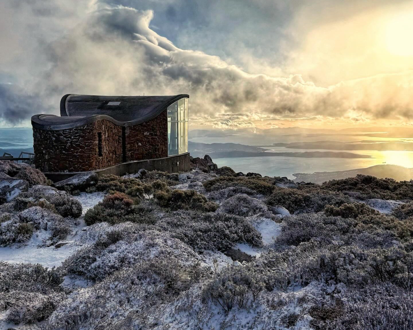
The summit is the simplest place to begin. Parking, toilets, open-air lookouts and an enclosed observation shelter sit close together, with views east across Hobart and the River Derwent and west towards the mountains of the Tasmanian Wilderness World Heritage Area.
There is no cafe at the summit. The exposed plateau can also be dramatically colder and windier than Hobart, so bring a warm and weatherproof layer even if the city is mild.
A short walk across the summit plateau gives a better sense of the alpine environment than staying beside the car park. The Zig Zag Track lookout can be reached in about 20 minutes return from The Pinnacle.
The Springs
The Springs sits at about 720 m and is the most useful base for walking. It has toilets, picnic tables, gas barbecues and the Lost Freight cafe, as well as direct access to the Pinnacle Track, Lenah Valley Track and several short walks.
The Lookout Circuit takes about 15 minutes on easy, mostly level ground. Sphinx Rock is a stronger short option: allow about 45 minutes return along the Lenah Valley Track to a sandstone platform with views towards the Organ Pipes, Hobart and the Derwent.
Sphinx Rock has a substantial cliff edge. The walk itself is short, but the lookout is not a place to step beyond the formed area for a photograph.
Organ Pipes
The Organ Pipes walk is 7.4 km return, takes about three hours and is Grade 3. It starts from The Springs on the Pinnacle Track, climbing roughly 400 m over the first 1.8 km before traversing beneath the dolerite columns.
The Organ Pipes rise up to about 120 m and are the mountain's most distinctive geological feature. The track continues beneath the cliffs to The Chalet, a stone shelter on Pinnacle Road. From there you can return the same way or arrange a pickup rather than retracing the full track.
The walk has rocky sections and is exposed to severe weather. Toilets, shelters and picnic facilities are at The Springs and Fern Tree, while The Chalet provides basic shelter but not full visitor services.
Walk down from the summit
The Zig Zag and Pinnacle tracks provide a direct walking route between The Pinnacle and The Springs. Allow about 1.5 hours one way. This works particularly well with a one-way bus ticket or a planned pickup.
Do not leave a car at the summit and assume the return transport will solve itself. Bus departures are timetabled, and road closures or weather can change the day's transport pattern.
Fern Tree and the lower mountain
Fern Tree is the lower walking gateway and can be reached by Metro bus from central Hobart. The easy Pipeline Track to Silver Falls takes about 40 minutes return and is a useful alternative when the summit is clouded in or Pinnacle Road is closed.
The change from fern gullies at Fern Tree to exposed boulder fields at the summit is one of the reasons not to treat kunanyi as a single lookout.
How much time to allow
A summit-only visit can fit into 1.5 to 2 hours from central Hobart, including the drive and time at the lookouts. Allow half a day if you add The Springs and Sphinx Rock.
The Organ Pipes turns the visit into a proper half-day mountain walk. If you intend to walk between the summit and The Springs as well, plan the transport first and give the mountain most of the day.
Practical notes
- Wellington Park is free to enter and a Tasmania parks pass is not required.
- Check the live Pinnacle Road status before driving. Snow and ice closures can occur at any time of year.
- Parking and toilets are available at The Pinnacle. The Springs also has toilets, picnic facilities and a cafe.
- There is no cafe at The Pinnacle and food and water options on the upper mountain are limited.
- Carry warm, windproof and waterproof clothing for walks above The Springs, even in summer.
- Drones cannot be launched or landed in Wellington Park without a permit.
- Campervans and motorhomes cannot be parked overnight in Wellington Park.
- The park closes to all users on days of Extreme or Catastrophic fire danger.
- Dogs are permitted only on approved tracks and must remain on lead.
A suggested plan
If the road is open and the summit is clear, drive or take the bus to The Pinnacle first. Spend time on the lookouts, then come back down to The Springs and choose between the short Sphinx Rock walk or the longer Organ Pipes route.
If cloud or snow closes the upper mountain, do not write the day off. Start at Fern Tree or The Springs instead and use the lower forest tracks, then return to the summit on another clear window.