
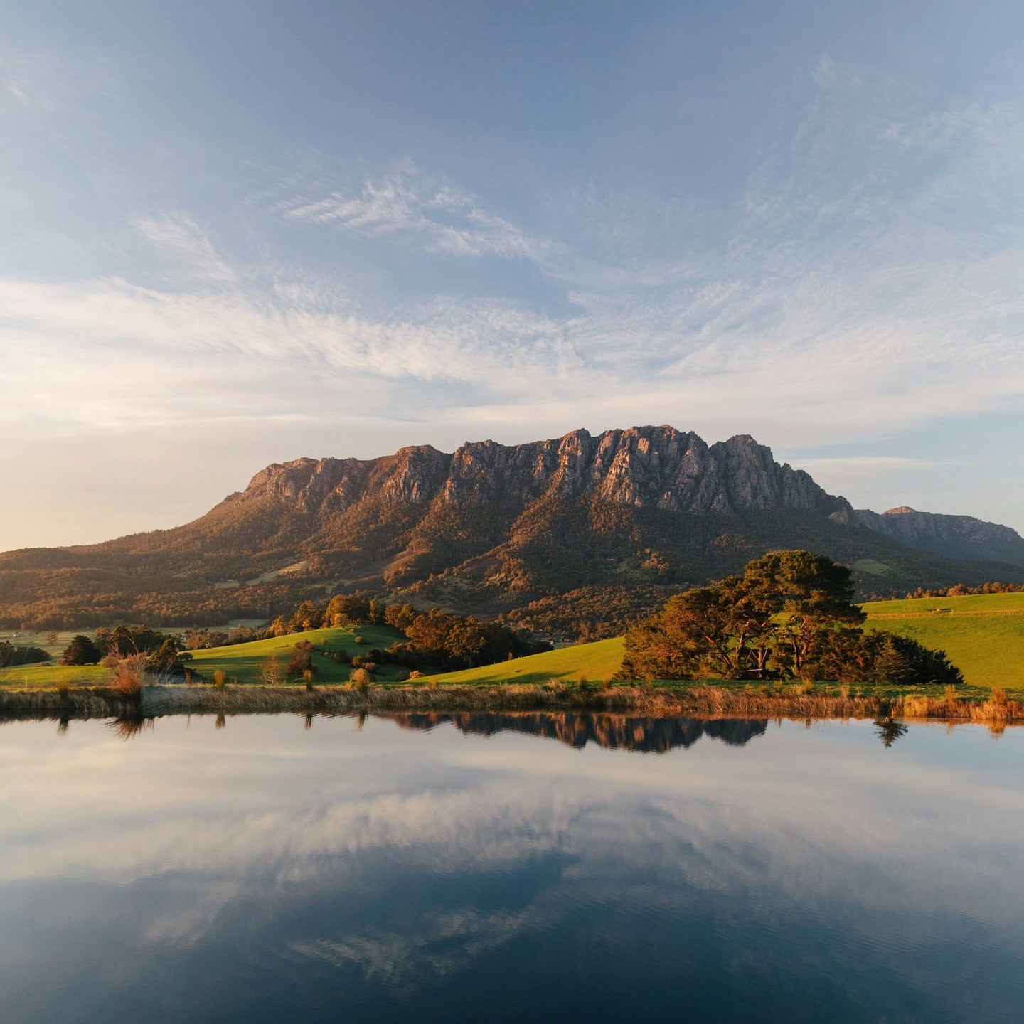
Mount Roland dominates the skyline south of Sheffield, but the preferred summit route starts on the quieter Gowrie Park side. The walk gains almost 1,000 m from the trailhead, moving from eucalypt woodland onto an open buttongrass plateau before a loose-rock approach and short final boulder scramble.
The mountain is long rather than technically difficult for most of the day. That changes near the top, where rougher footing and alpine weather make the final section more serious than the Grade 3 label can suggest at first glance.
How to get there
From Sheffield, follow Claude Road (C136) for about 15 km to Gowrie Park. Turn left onto O'Neills Road and follow the unsealed road for about 1 km to the Mount Roland trailhead. The track starts opposite the car park and is signed.
There are no toilets, water or picnic facilities at the trailhead. The closest public facilities are at Gowrie Park, where the O'Neills Creek Picnic Reserve has toilets, picnic facilities and camping.
The route in this guide uses the O'Neills Road track. Discover Tasmania also describes a steeper Kings Road or Face Track, but explicitly does not recommend it because of its steep, awkward and potentially dangerous terrain.
What to see and do
The climb through the forest
The walk begins gently through eucalypt woodland, then steepens steadily as the track gains most of its elevation. The full return is 16 km and takes about 4 to 6 hours, so the early forest should be treated as the beginning of a substantial mountain day rather than a short approach.
The climb is sustained. Keep enough in reserve for the descent, particularly after wet weather when roots and loose surfaces can slow the return.
The plateau
Once the track reaches the high plateau, the vegetation opens into buttongrass plains and heath. After about 15 minutes on the plateau there is a viewing platform with a table and bench seats.
This is a useful decision point. The view is already broad here, so if cloud is closing in over the summit or the group has used more time than expected on the climb, turning around still gives the walk a natural conclusion.
The summit
Beyond the platform the surface becomes rougher, with loose rocks underfoot before a short boulder scramble onto the summit. Mount Roland reaches 1,233 m and, in clear weather, the top opens to 360-degree views.
To the north, the view extends across the Kentish farmland towards Bass Strait. To the south-west, Cradle Mountain, Barn Bluff and the Pelion Range can be visible on a clear day.
The summit is exposed. Snow, rain, strong wind and low cloud can arrive quickly, so reaching the plateau should not create pressure to continue if conditions have changed.
O'Neills Creek Nature Trail
If you want to begin from Gowrie Park rather than driving the final kilometre, the O'Neills Creek Nature Trail links the picnic reserve with the Mount Roland trailhead. It is 1 km one way and takes about 20 minutes.
The track follows the creek through wet forest with interpretation panels along the route. Adding it makes the summit day longer, but it also gives a much gentler beginning and finishes beside the facilities at Gowrie Park.
Mount Claude and Mount Vandyke
The reserve has other worthwhile walks, but they are not casual add-ons to Mount Roland. Mount Claude Lookout is 5 km return, about two hours and Grade 4. It starts from the Round Mountain Lookout area and climbs quickly on a gated service road before becoming rougher.
Mount Vandyke is 11 km return, 3 to 4 hours and Grade 4. Parks and Wildlife describes it as challenging to navigate, with steep ascent and descent and boulder scrambling. It can be combined with Mount Roland as a circuit, but that variation is better left to experienced bushwalkers rather than treated as the standard return route.
How much time to allow
Allow the full 4 to 6 hours quoted for the walk, plus time at the summit and a buffer for rough or wet ground. Starting early matters because the route is exposed once it reaches the plateau and there are few useful shortcuts back to the car.
Coming from Devonport, Mount Roland can still be a day trip. From Hobart or Launceston, the driving turns it into a much longer day and makes an early start more important.
Practical notes
- There are no facilities at the O'Neills Road trailhead. Toilets and picnic facilities are at Gowrie Park.
- O'Neills Road is unsealed for the final kilometre to the trailhead.
- Carry waterproof jacket and over-trousers, warm layers, hat and gloves, sturdy boots, food and enough water for a 4 to 6 hour alpine walk.
- Record your trip intentions, tell someone your plan and be prepared to turn around if the weather changes.
- Campfires, dogs and bikes are not permitted on the Mount Roland walking track or within the reserve.
- Stay on the formed track to protect the sensitive alpine vegetation.
- The Kings Road or Face Track is not the preferred route and is described by Discover Tasmania as steep, awkward and potentially dangerous.
A suggested plan
Start from O'Neills Road early and take the forest climb steadily. Use the plateau platform as the first major stop and a genuine weather check.
If the summit is clear, continue over the loose rock and final boulder section, spend time on top, then return the same way. Keep Mount Vandyke for another day unless the group has the navigation experience and time for the more difficult circuit.