
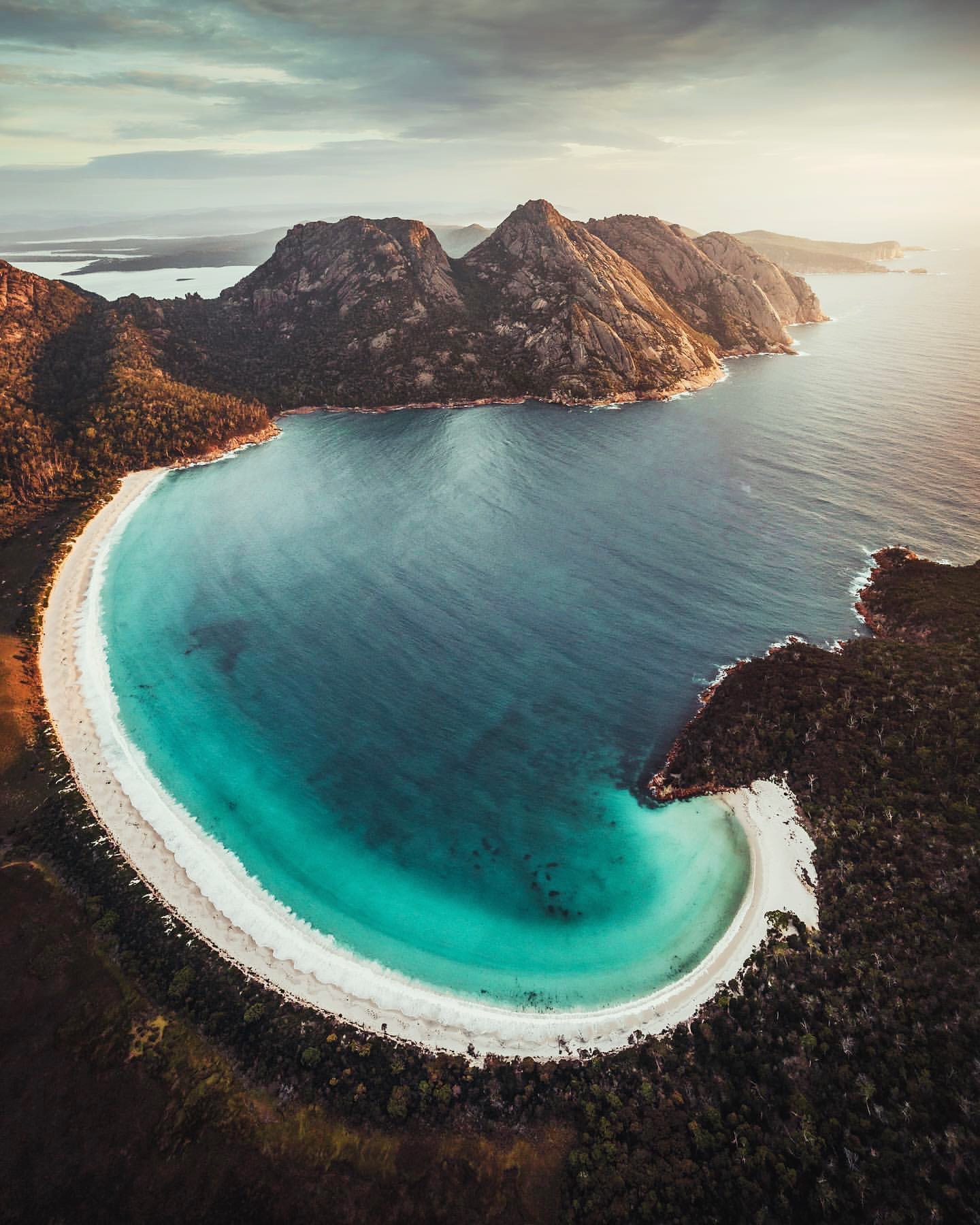
Wineglass Bay is one of Tasmania's classic coastal views, but the lookout is only the first decision. From the same starting point, the walk can end at the viewing platform, continue down to the beach, or become a longer circuit via Hazards Beach.
How to get there
From the Tasman Highway (A3), turn onto Coles Bay Road (C302), 12 km south of Bicheno. Continue through Coles Bay to the main entrance of Freycinet National Park, then follow signs to the Walking Tracks Car Park.
Freycinet is about 2.5 to 3 hours by road from either Hobart or Launceston. A valid Tasmania parks pass is required to enter the national park.
What to see and do
Wineglass Bay Lookout
The lookout walk is 2.6 km return and usually takes 1 to 1.5 hours. It is Grade 3, with a steep uphill section, plenty of steps and sections of granite and loose gravel. The reward is the sweeping view over Wineglass Bay from above.
The climb is about 1.3 km each way through coastal woodland and granite boulders, with resting seats on the steeper sections. The lookout is reached from the saddle between Mount Mayson and Mount Amos, where platforms face directly into the curve of the bay.
If your goal is the view rather than the beach, this is a complete walk in its own right. The descent to Wineglass Bay adds roughly another 3.4 km return and a much larger amount of climbing on the way back.
Walk down to Wineglass Bay
Continue from the saddle and the walk becomes 6 km return, usually taking 2.5 to 3.5 hours. The descent includes about 1,000 stairs, so the climb back up is worth keeping in mind before committing to extra time on the beach.
There is a composting toilet at Wineglass Bay, but no rubbish bins, so everything carried in needs to be carried back out.
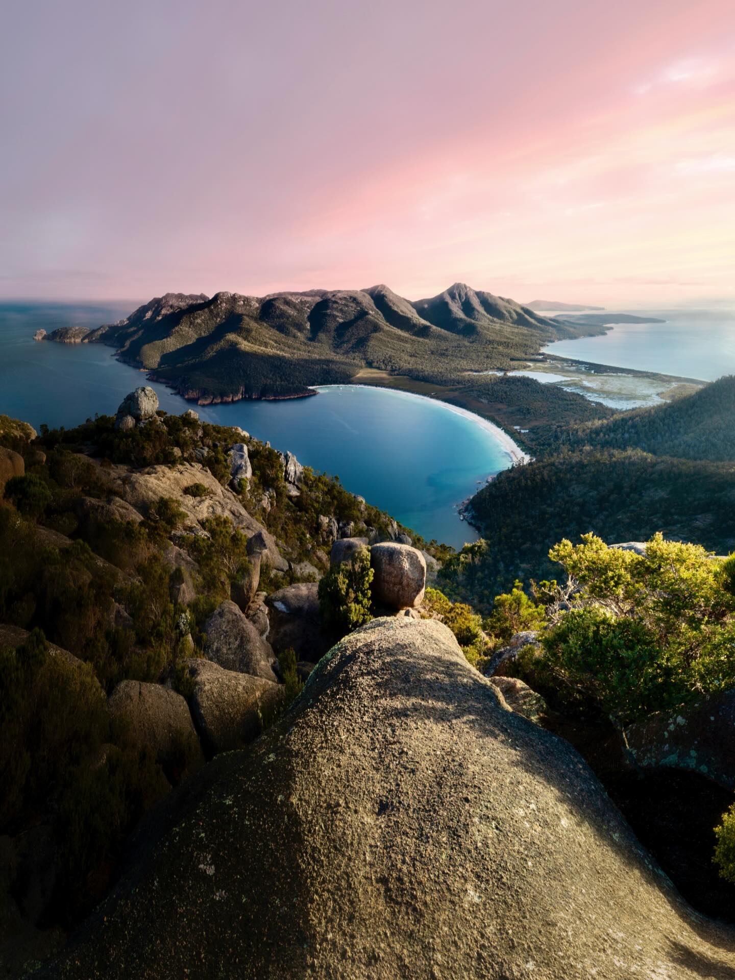
Once on the sand, allow another 20 minutes if you want to walk towards the southern end of the beach for the reverse view back to the Hazards. The beach is unpatrolled, and there are no bins, food outlets or drinking-water taps once you leave the walking tracks car park.
Wineglass Bay and Hazards Beach circuit
For a bigger day, the 11 km Wineglass Bay and Hazards Beach circuit takes about 4 to 5 hours and is Grade 4. The route descends to Wineglass Bay, crosses the isthmus to Hazards Beach and returns through coastal woodland, with views across Great Oyster Bay on the way back.
After crossing Wineglass Bay, the track cuts across the broad isthmus to Hazards Beach. From there it follows the beach before climbing inland through she-oak forest and coastal woodland around Mount Mayson. Seasonal creeks and rougher sections make the return feel longer than the distance suggests.
Mount Amos
Mount Amos is the serious alternative to the lookout, not an extension to it. The track is 3.6 km return, takes about three hours and is Grade 4. It climbs directly over steep granite slabs and requires hands-on scrambling in places.
Do not attempt Mount Amos when the granite is wet or rain is likely. The rock becomes extremely slippery, the summit is exposed, and there are no facilities once you leave the car park. Robust footwear and a realistic assessment of confidence on steep rock matter more here than the relatively short distance.
Add another Freycinet stop
Sleepy Bay is a short 500 m return walk to a rocky shoreline and takes about 20 minutes. Friendly Beaches has Grade 2 walking options ranging from 100 m to 5 km, while Honeymoon Bay has picnic tables, electric barbecues and toilets.
A different view from Mount Amos
Walkers seeking a much harder Freycinet outing can consider Mount Amos, which looks across Wineglass Bay from a steep granite summit. It is a separate Grade 4 walk, not a continuation of the Wineglass Bay lookout route. Parks Tasmania warns against attempting it in wet conditions or when rain is likely.
How much time to allow
Allow 1 to 1.5 hours for the lookout, 2.5 to 3.5 hours to walk down to Wineglass Bay and back, or 4 to 5 hours for the Hazards Beach circuit. Add extra time for breaks, photographs and any other stops around Freycinet.
Practical notes
- Sturdy footwear is useful on the steep granite and loose-gravel sections.
- The beaches in the park are unpatrolled.
- Toilets are available at the Walking Tracks Car Park.
- Drinking water is limited. Refill points are available at the visitor centre and the Wineglass Bay Walking Tracks Car Park.
- Recreational drones are not permitted within Tasmanian national parks and reserves.
- Food attracts possums around the walking-track area, so keep bags closed and food secured rather than leaving it unattended.
- Mount Amos should be treated as a separate Grade 4 objective. Do not add it casually after the lookout or beach walk.
A suggested plan
If time is tight, make the lookout the focus. With half a day, continue down to Wineglass Bay and return the same way. For a longer walk, the Hazards Beach circuit turns the visit into a broader loop through Freycinet rather than a simple out-and-back.