
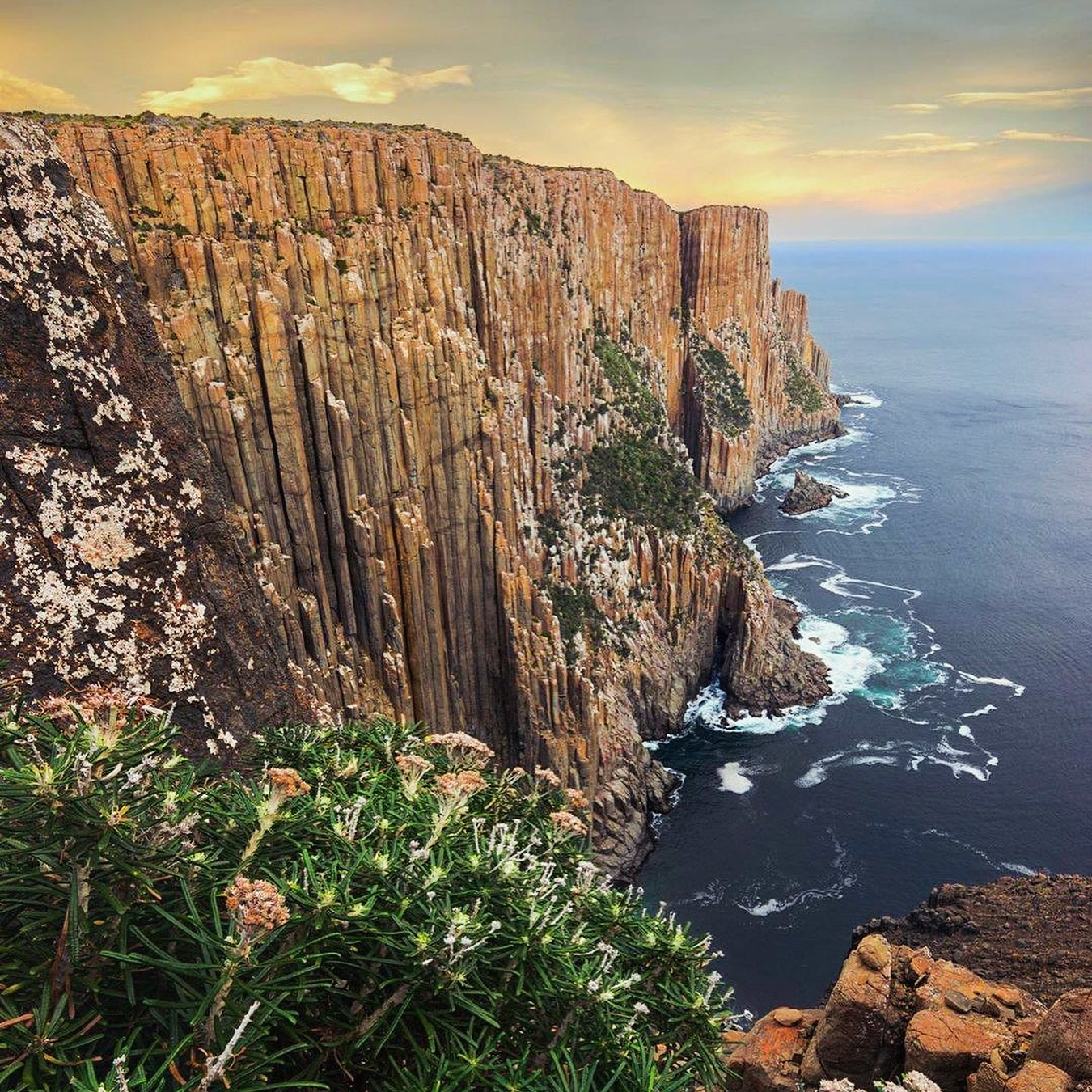
Cape Raoul earns its drama slowly. The first section is forested, then the track reaches the cliff edge and the scale changes at once. From there, dolerite columns and open ocean stay close to the route all the way towards the cape.
At 14 km return, it is a proper half-day walk rather than a viewpoint stop. That distance is exactly what keeps the experience coherent: forest, heath, cliffs and the exposed end of the peninsula all belong to the same walk.
How to get there
From Port Arthur, take the B37 west for about 8 km, then turn towards Highcroft and Stormlea at Parsons Bay Creek. Follow Stormlea Road for around 9 km to the Cape Raoul car park.
The final approach is on dirt road. The walk begins directly from the trailhead in Tasman National Park.
What to see and do
The first cliff edge
The early part of the walk climbs through open forest before reaching the first major cliff views. This is where the track changes from an inland bushwalk into a coastal one.
Do not treat the first viewpoint as a safe place to wander for a better angle. The cliffs are high, exposed and in places unprotected.
The early forest climb can make the walk feel gentler than it ultimately is. Once the track reaches the cliffs, long exposed sections and repeated viewpoints continue for much of the remaining route, so use the first cliff edge as a genuine weather check.
The walk along the cape
Beyond the first lookout, the track continues through heath and light forest with repeated views of the dolerite coastline. The walking is long rather than technically complex, but the combination of rough ground, exposure and distance gives the route its Grade 4 classification.
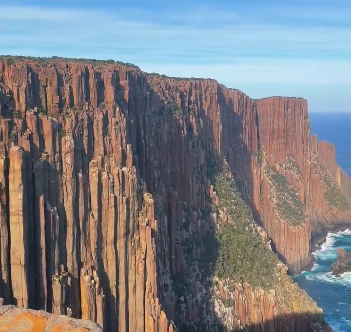
The route alternates between coastal heath, light forest and exposed cliff country rather than staying continuously on the edge. Directional signage can be limited on Grade 4 sections, and the rougher ground becomes more tiring on the return than the outward views suggest.
The end of the cape
The final section brings the scale of the dolerite columns into full view above the Southern Ocean. Allow time here rather than calculating the walk around a five-hour minimum and immediately turning back.
There are no visitor facilities at the end of the walk. Carry enough water and food for the full return distance and keep the final stop within a daylight margin rather than using all available time at the cliffs.
How much time to allow
The official walking time is about five hours return. Give yourself six if you want a relaxed lunch stop, photography and time at the cliffs.
From Hobart, Cape Raoul is a full-day outing once the drive is included. Do not pair it with another major Tasman Peninsula walk on the same day.
Practical notes
- A valid Tasmania parks pass is required.
- The walk is 14 km return and Grade 4.
- Cliff edges are hazardous and some sections are unprotected. Keep well back.
- Strong wind and wet rock materially change the risk around exposed viewpoints.
- The final road to the trailhead is unsealed.
- Carry enough food, water and weather protection for a five-hour coastal walk.
- The official Grade 4 classification reflects length, rough surfaces and exposure as well as the total distance.
- There are no facilities at the cape itself, so food, water and weather protection need to be carried from the trailhead.
A suggested plan
Start early enough that the walk does not become a race against the afternoon. Take the forest section steadily, pause at the first cliff views, then continue to the end of the cape for lunch before retracing the route.
If the wind is strong at the first exposed section, that is useful information. Turn around rather than assuming conditions will improve further out.